Manifold, founded in 2022, develops 3D reconstruction and perception algorithms for drones and robots. These algorithms allow them to sense their environments, retain memory of the environment, and interact in real time with their surroundings. The founding team of the company comes from the Mechatronics and Robotic Systems Lab (MaRS) at the University of Hong Kong. This lab focuses on drone navigation, control and SLAM using LiDAR. Professor Zhang Fu, former head of the MaRS Lab, founding member of Livox and former scientific adviser to DJI, advises Manifold now on technical strategy.
As machine learning and artificial intelligence technologies continue to develop, 3D sensing has become more accurate. Commercial platforms powered with high-performance parallel processing can now process large volumes images and point clouds quickly, enabling rapid reconstruction of outdoor scenes and items. These capabilities find applications in a wide range of industries.
In the preservation of cultural heritage, high-resolution replicas of historical artifacts and buildings support long-term conservation. They also open up opportunities for educational programs and virtual exhibitions. In emergency response, 3D data can help reconstruct the layout of fire sites, trace ignition points, and analyze burn patterns and structural integrity–ultimately enabling faster, more informed decisions after a disaster.
Spatial memory and perception are particularly important for robotics. Autonomous machines that navigate complex environments must be able to detect and remember obstacles, paths, and spatial configurations in order to move safely and plan routes efficiently. Many existing systems are limited. GPS signals can be unreliable inside, and alternatives like Bluetooth or ultra-wideband require fixed infrastructure. Visual and LiDAR systems can fail in dynamic or unfamiliar environments, resulting in navigation errors.
The current hardware presents other challenges. Manual calibration can be time-consuming and requires expert reconfiguration of parameters when hardware or environment changes. The development teams must manage large datasets, and continually fine-tune algorithms for specific scenarios. This increases costs and delays timelines.
In order to address these issues Manifold developed MindSLAM – a multi-sensor, solid-state architecture powered by proprietary algorithms. Odin 1 is at its core, which the company describes the first module in the world to combine spatial perception with memory.
Odin 1 is equipped with a SPAD (single photon avalanche avalanche diode), dTOF (depth sensor) dTOF, a high resolution color camera and an inertial measuring unit. The system synchronizes spatial-temporal data between sensors to ensure accurate and consistent outputs. Manifold claims that Odin 1 provides centimeter-level location, detects objects as far away as 70 meters, and has a 120 by 90-degree field-of-view. It generates point cloud data at a rate 700,000 points per seconds, improving data granularity.
Odin 1 functions like the hippocampus, which is a biological system that governs spatial memory. Odin 1 can create detailed 3D maps and spatial memory frameworks by aligning spatial and time data, even when there is low light or limited features. Odin 1 allows robots and drones to detect object orientation and location with high precision, and create real-time environment maps in challenging conditions. These capabilities enhance autonomous navigation, allow for more efficient route planning and support better performance under complex scenarios. MindSLAM can be integrated with Manifold’s MindCloud platform to allow users to convert photorealistic 3D models of real-world environments with just a click. The platform supports digital-twin generation, spatial-data management, and simulation based training for robotics algorithm, providing a basis for development and operational decisions.
According to 36Kr, Manifold’s real-time, true-color 3D reconstruction tools are already being used in sectors such as construction digitization, renovation measurement, fire site modeling, traffic accident documentation, and industrial manufacturing.
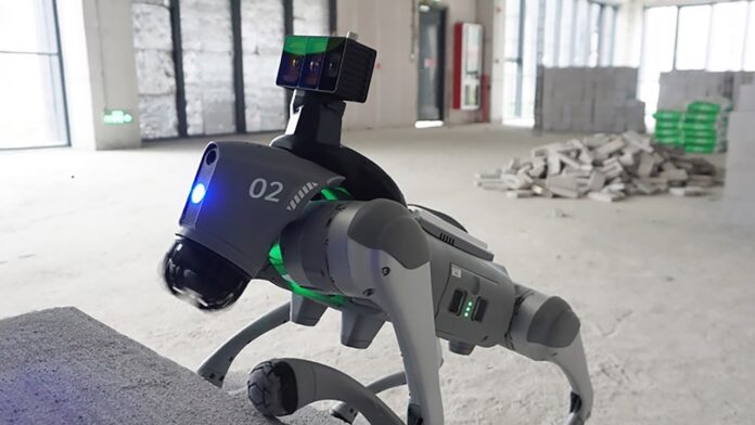
In practice, drones and robots equipped with Odin 1 can enter disaster zones to deliver real-time 3D maps, helping emergency responders access accurate structural information. On construction sites, Odin 1 can log spatial changes, track progress, and assess build quality, streamlining project management and reducing labor demands.
Manifold is collaborating with several robotics manufacturers to lower the cost of smart sensing modules and offer integrated solutions for navigation, scanning, and localization. Odin 1 is scheduled to enter mass production in July and will be launched globally thereafter.
KrASIA Connection features translated and adapted content that was originally published by 36Kr. This article was written by Huang Nan for 36Kr.


